Conduciendo desde Magdalena al Río Sonora

Conducir desde Magdalena al Río Sonora

En el camino en Sonora, México

Conducir desde Magdalena al Río Sonora

Hay diferentes maneras de llegar a la carretera del río Sonora conocida como la Ruta del Río Sonora. Puede comenzar desde el norte, en Cananea, o desde el sur desde Hermosillo hasta Ures y hasta la carretera de Río Sonora.

Otra ruta que quizás sea la más conveniente para explorar la Ruta del Río Sonora es a través de la carretera Kino, desde Magdalena hasta Sinoquipe, Sonora.

En un día agradable en enero de 2018 con temperaturas perfectas y abundante sol, me senté en la habitación de mi hotel en Magdalena de Kino y estudié el mapa de Google de la zona en mi teléfono.

Esta fue la última etapa de un viaje de conducción que había comenzado en Navojoa, Sonora, a través del sur de Sonora, Hermosillo, la costa de Caborca, Puerto Peñasco, el Golfo de California a San Luis Río Colorado y la región fronteriza del oeste de Sonora y ahora a Magdalena . Y quería conducir la Ruta del Río Sonora antes de devolver mi auto alquilado al sur de Sonora.

Había conducido la carretera 2 de Sonora desde Imuris a Cananea y no me gustó especialmente, porque sus giros sinuosos en la ladera combinados con el tráfico pesado podrían convertirlo en un viaje desafiante.

Una vez llegué a un giro ciego al este de Imuris y tuve que hacer un giro de una fracción de segundo para el hombro (afortunadamente había uno) para evitar una colisión frontal con un semirremolque de una casa manufacturada de doble ancho que conducía en el medio de la carretera.

Con eso, aunque todavía en mente, consideré tomar una ruta alternativa. En lugar de conducir a Cananea y comenzar el recorrido a lo largo del Río Sonora donde comienza la carretera estatal 89, consideré conducir desde Magdalena a Sinoquipe en la carretera 54 de Sonora, un viaje de menos de dos horas que también pasa por el pueblo de Cucurpe, que tenía nunca visitado

Todos los que pregunté dijeron que el camino a Cucurpe y Sinoquipe estaba en buenas condiciones, y tenían razón. Parecía haber sido repavimentado recientemente, y con la excepción de los últimos 12 km (cinco millas) más o menos al final de la unidad, la carretera está en muy buenas condiciones.

Para llegar a la autopista desde la autopista 15, también conocida como Avenida Niños Heroes, a su paso por Magdalena, puede girar hacia el sudeste en la esquina donde se encuentra la gran tienda departamental Coppel, o en la intersección donde se ve el pequeño monumento al campanario.

Cualquiera de las calles pasará a través de una sección residencial de Magdalena antes de que se cruza con la carretera. Esta ruta también es históricamente significativa, y conocida como la Carretera de Kino, porque el sacerdote jesuita Padre Eusebio Francisco Kino tomó la ruta a Magdalena cuando salió de Cucurpe en marzo de 1687 para comenzar su importante trabajo en la región.

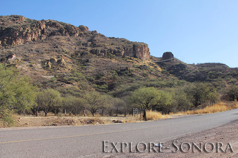
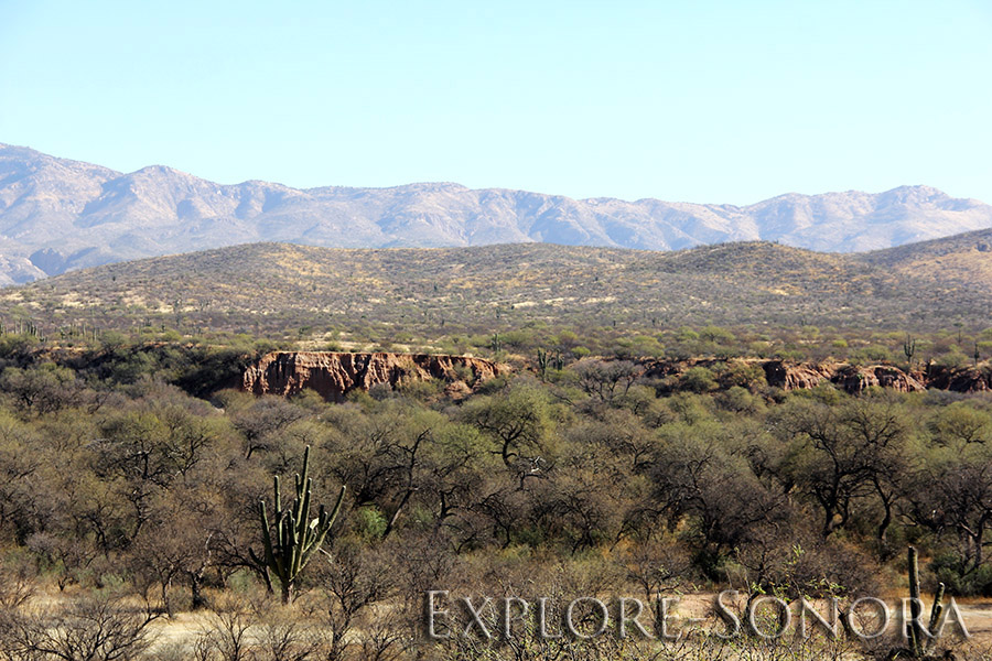
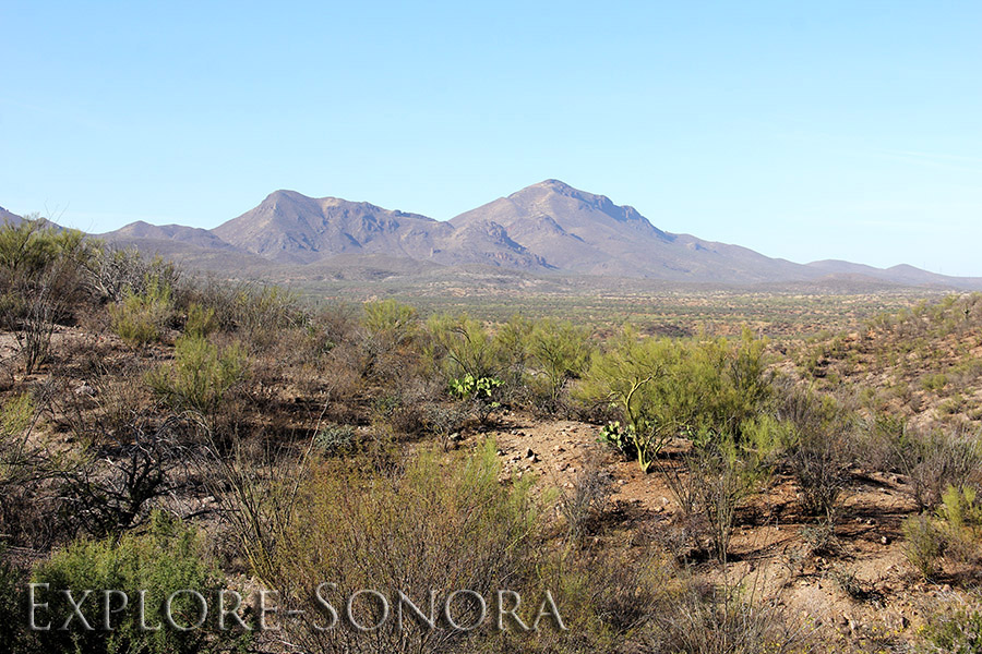
El viaje en coche fue muy agradable, hermosos paisajes y muy poco tráfico. La carretera tiene muchas curvas y colinas, y hay lugares donde puedes aparcar y disfrutar del paisaje a lo largo del camino, pero no conduzcas demasiado rápido o no tendrás tiempo suficiente para salir de la carretera.

Use las precauciones usuales al conducir en carreteras rurales de Sonora: luces encendidas, estar alerta, no pasar otros vehículos, mantener la vista en la carretera y conducir a una velocidad razonable.

El viaje en coche desde Magdalena dura aproximadamente 40 minutos hasta que la carretera desciende al encantador e histórico pueblo de Cucurpe, Sonora.

Cucurpe a Sinoquipe

Después de salir de Cucurpe, el camino una vez más asciende hacia las colinas y las curvas montañosas. No muy lejos de Sinoquipe, hay un lugar de estacionamiento en el Cajon de la Piedra Lisa, donde el capitán Juan Batista de Anza y su expedición fueron atacados en medio de la noche y apenas escaparon vivos.

Esta es una primera muestra de la presencia española, de exploradores, conquistadores y misioneros, que tuvo una gran influencia en los pueblos del Río Sonora. De hecho, el cuerpo del capitán de Anza, quien dirigió su expedición a la región del norte de California que ahora es San Francisco, está enterrado en una cripta de mármol en la hermosa iglesia misionera de Arizpe, Sonora.

Los últimos 12 kilómetros (aproximadamente siete millas) de la carretera están en mal estado, aunque son transitables. Un equipo de la carretera estaba haciendo un trabajo menor, pero no parecía que iba a terminar pronto. En cualquier caso, el pequeño inconveniente era tolerable, especialmente considerando cuán buenas eran las carreteras para la mayor parte de la unidad.

Y al doblar la esquina final de la carretera y ver los maravillosos acantilados rocosos y la pequeña ciudad que se encuentra delante, ha llegado a Sinoquipe, a lo largo de la Ruta del Río Sonora.

Paisaje de la carretera 54 de Sonora entre Magdalena y Cucurpe, Sonora, México
Paisaje de la carretera 54 de Sonora entre Cucurpe y Sinoquipe, Sonora, México
Capilla de camino cerca de Sinoquipe, Sonora, México

Driving from Magdalena to the Rio Sonora

Driving from Magdalena to the Rio Sonora

On the Road in Sonora, Mexico

Drive from Magdalena to the Rio Sonora

Important note: This driving route is outside of the Sonora Free Zone, so a Banjercito vehicle permit (federal or Sonora Only) is required to drive in this territory of Sonora. I was driving a Mexican rental car that did not require a permit. Even though there are no customs stations or signage along the way, be aware that foreign vehicles are not allowed in this area without an importation permit.

There are different ways to reach the Sonora River highway known as the Route of the Rio Sonora. You can start from the north, at Cananea, or from the south from Hermosillo to Ures and on to the Rio Sonora highway.

Another route that is perhaps the most convenient way to explore the Route of the Rio Sonora is via the Kino highway, from Magdalena to Sinoquipe, Sonora.

On a pleasant day in January 2018 with just-right temperatures and abundant sunshine, I sat in my hotel room in Magdalena de Kino and studied the Google map of the area on my phone.

This was the last leg of a driving trip that had started in Navojoa, Sonora, through Southern Sonora, Hermosillo, the Coast of Caborca, Puerto Peñasco, the Golfo de California to San Luis Rio Colorado and the Western Sonoran border region and now to Magdalena. And I wanted to drive the Route of the Rio Sonora before returning my rental car to Southern Sonora.

I had driven Sonora highway 2 from Imuris to Cananea and did not particularly like it, because its sinous mountainside turns combined with heavy traffic could make it a challenging drive.

I once came around a blind turn east of Imuris and had to make a split-second swerve for the shoulder (thankfully there was one) to avoid a head-on collision with a semi hauling a double-wide manufactured home that was driving in the middle of the highway.

With that though still in mind, I considered taking an alternate route. Rather than driving to Cananea and starting the drive along the Rio Sonora where state highway 89 begins, I considered driving from Magdalena to Sinoquipe on Sonora highway 54, a drive of less than two hours that also passes through the pueblo of Cucurpe, which I had never visited.

Everyone I asked said that the road to Cucurpe and Sinoquipe was in good condition, and they were right. It looked to have been repaved recently, and with the exception of the last 12km (five miles) or so at the end of the drive, the highway is in very good condition.

To get to the highway from highway 15, also known as Avenida Niños Heroes as it passes through Magdalena, you can either take a turn to the southeast on the corner where the large Coppel department store is located, or at the intersection where you see the small bell tower monument.

Either street will pass through a residential section of Magdalena before it intersects with the highway. This route is also historically significant, and known as the Kino Highway, because Jesuit priest Father Eusebio Francisco Kino took the route to Magdalena when he left Cucurpe in March of 1687 to begin his significant work in the region.

The drive was very nice – beautiful scenery and very little traffic. The highway has a lot of curves and hills, and there are places where you can park and enjoy the scenery along the way, but do not drive too fast or you will not have enough time to safely pull off the road.

Use the usual precautions when driving on Sonoran rural highways – headlights on, be alert, do not pass other vehicles, keep your eyes on the road and drive at a reasonable speed.

The drive from Magdalena takes about 40 minutes until the road descends into the lovely, historic pueblo of Cucurpe, Sonora. Read more about Cucurpe.

Cucurpe to Sinoquipe

After leaving Cucurpe the road once again ascends into the hills and mountainous curves. Not far from Sinoquipe, there is a roadside parking spot at the Cajon de la Piedra Lisa (Smooth Stone Box Canyon), where Captain Juan Batista de Anza and his expedition were attacked in the middle of the night and barely escaped alive.

This is a first taste of the Spanish presence – from explorers, conquistadors and missionaries – that had such a large influence on the pueblos of the Rio Sonora. In fact, the body of Captain de Anza, who led his expedition to the Northern California region that is now San Francisco, is interred in a marble crypt in the beautiful mission church of Arizpe, Sonora.

The last 12 kilometers (about seven miles) of the highway is in bad condition, though passable. A road crew was doing some minor work, but it did not look like it was going to be finished any time soon. At any rate, the small inconvenience was tolerable, especially considering how good the roads were for most of the drive.

And as you turn the final corner of the highway and see the marvelous rocky cliffs and small town ahead, you have arrived at Sinoquipe, along the Route of the Rio Sonora. Read more about the Rio Sonora.

Scenery from Sonora highway 54 between Magdalena and Cucurpe, Sonora, Mexico
Scenery from Sonora highway 54 between Cucurpe and Sinoquipe, Sonora, Mexico
Roadside shrine near Sinoquipe, Sonora, Mexico